Use of different national classifications in CMSi for the vegetation map importer and for the GIS-reports in CMSi
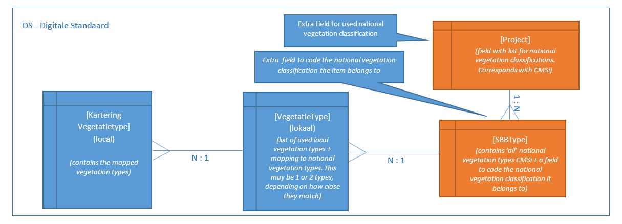
The Dutch use a "Digitale Standaard" (DS) for vegetation mapping which brings together different vegetation classification schemas into a new protocol. Local classification types are mapped to national vegetation types
Every Digitale Standaard contains a mapping from local types to one primary national classification.
This can be the TBO, VVN, rVvN, Salt, etc.
National Vegetation data can be imported into a vegetation map. The data is a comprised of a shapefile of the vegetation map and an acompanying MS mdb file containing the samples. Having done so, data from the local samples may be linked to the imported national vegetation type map. Local vegetation type data may be held in TurboVeg from where it may be exported to an xml file for import into CMSi.
Key Criteria for the DS and CMSi
- There must be backwards compatibility between the CMSi importer and the DS
- It must be possible to select which National Vegetation Classification is used at Import
- It must be possible to import the relationship between local and national vegetation types
- There must be extension of the use of different national classifications in the Vegetation Module
- The National Vegetation classifications have a key-function in the GIS-reports of CMSi. These GIS-reports must have the option/flexibility to work with other national vegetation classifications. At this moment the Vegetation module functionality (relationships between different local classifications, GIS reports etc.) are based on the use of the TBO classification and the VVN classification. This functionality must be able to use other national classifications
Importing Vegetation data and Creating a GIS Report
Open a Vegetation Map form from the Vegetation Tree and Click on the Import vegetation data button
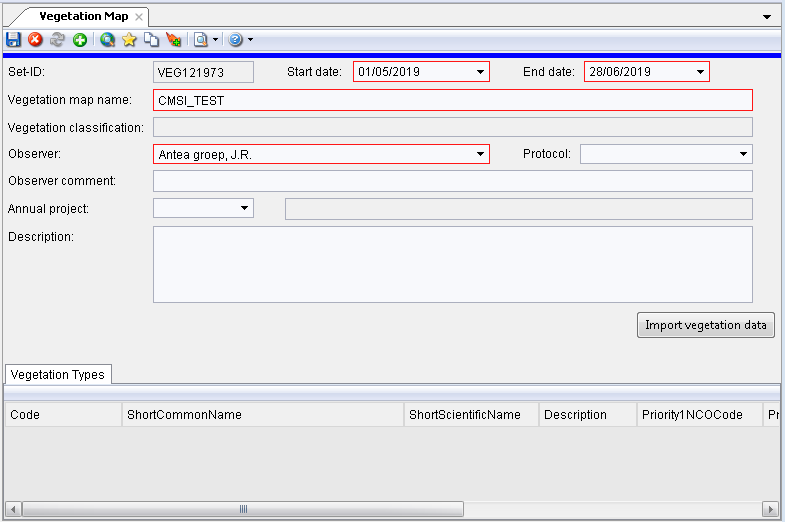
Browse to the Access Database and shapefile
Choose the type of vegetation Classification you will be importing e.g.
TBO Nationale Vegetatie Typologie or
RVVN Nationale Vegetatie Typologie
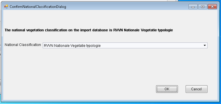
With a Successful import all of the relevant data is brought in to the Vegetation Map Form, with a fully populated list of Vegetation Types which will show the corrsponding Local and National Vegetation schemas and their classifications
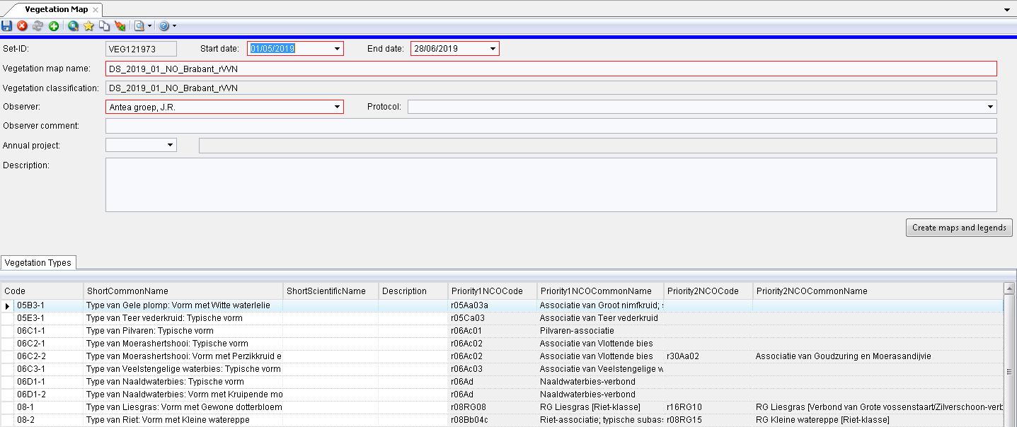
It is then possible to go on and create a GIS Report, map and legend
Turboveg Importer
Local vegetation samples may be held in TurboVeg from where it may be exported to an xml file for import into CMSi. A vegetation sample is sometimes referred to as a relevee and is a type of Set with additional attributes. So VegetationSamples and Sets have a one-to-one relationship via their GUIDS.
Turboveg XML importer is used to import Relevees (types of Sets) to CMSi. The Turboveg XML importer has the option to link imported Relevees to a Vegetation map.
Till now all local vegetation types of vegetation maps are related to one standard National classification (NCO). Relevees linked to a vegetation map have to fields were the relevees classified into the same standard National classification (NCO).
The relevees imported with the Turboveg importer must be linked to the primary national classification of the vegetation map. (field Turboveg database: SBB_TYPE1, SBB_TYPE2). The importer should check if the presented codes in SBB_TYPE1 and SBB_TYPE2 are existing in the primary national classification of the vegetation map.
The TurboVeg Importer is access via the View - Components - Observation menu
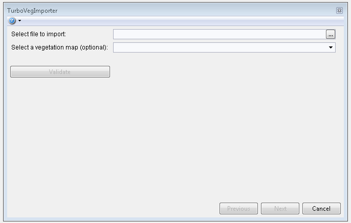
An xml file containing the TurboVeg data is selected, and an optional vegetation map relating to the site can be selected
After clicking on the Validate button the importer checks against the national catalogues used in the vegetation map schema; and the codes in Sbb-type1 and Sbb-type2 are validated against the codes of the national catalogues belonging to the chosen vegetation map.
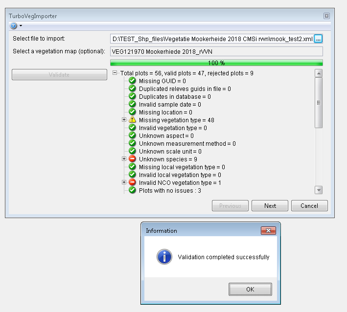
Indicators and warnings are given where data is successfully validated, where data might be missing from the Digital standard schema, or where data is invalid
The next step is to Match authors to Contacts in the database
Enter a Contact Name (e.g. 'ant') - Click Next
Import Valid data - Import Completed Successfully - OK - Finish
The TurboVeg Importer re-uses existing locations for plots. The geometry type used is VO which translates to "User defined point with administrative length, width and area."
The check for an existing location is based on its x and y coordinates and geometry type - not its code. When a new location is created, the code is created from the x and y coordinates.
Dim code As String = String.Format("{0},{1}", coordinateX, coordinateY)